DataScout covers all your mapping needs...
DataScout, LLC’s Geospatial Division provides GIS related services to state, local, and private entities through mapping, software development, consulting, and technical support.
-
GIS Data Development
We offer initial mapping and on-going maintenance for parcels, road centerlines, address points, voting and retail districts, and a variety of other datasets.
-
GIS Technical Services
Our team can assist with system planning, design, deployment, and support from ArcGIS Desktop to ArcGIS Server and Enterprise Geodatabases.
-
GIS Application Development
We have over ten years of experience designing and implementing custom map viewers/editors, ArcGIS add-ins, and GIS focused mobile applications.
Bringing Everyone & Everything Together
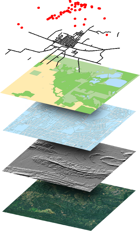
DataScout OneMap is a web-based mapping system that provides a single-source map viewer for county offices. Share, edit, analyze, plan, and collaborate with other county officials all in one place without needing to invest in onsite hardware. Use tools that are intuitive and targeted specifically for your office by a company that specializes in and understands local government.
Both the desktop and mobile versions allow for viewing, editing, sharing and publishing of geographic data with similar features and functionality. This allows users to switch between devices without having to learn a different user interface or purchase expensive data collectors.
OneMap Features
- Google Maps Imagery and Search
- Google Streetview
- Supports Any 3rd Party Imagery
- Data integration from any 3rd party
- Curated Reference Layers
- Single Click Export of Any Dataset
- Dynamic Reports and Analysis
- Automation of Common Tasks
- Permissions Based Feature Editing
- Error and Conflict Detection
- Map Notes & Markup
- Secured Logins for Controlled Access
- Mobile Friendly with GPS Tracking
- Integration with Public Records Website
- Much More