Consulting Services
What we offer...
Custom Application Development
We have an experienced and highly trained team of project managers, software engineers, GIS developers, and database admins ready to design and deliver a custom software solution uniquely suited for your organization.
Strategic Assessment
and Consultation
Do you have more questions than answers? DataScout Consulting is here to help by listening to your needs, assessing your goals, and developing a complete project plan to tackle even the most daunting challenges.
Extended Maintenance
and Training
Once the project is complete, DataScout can arrange long-term maintenance for delivered solutions or provide your team with the technical documentation and training needed for in-house upkeep.
Our approach...
1) Discover
- Identify and interview key stakeholders.
- Gather requirements and define key deliverables.
2) Design
- Connect the dots and present an end to end solution for your consideration.
- Utilize your continued feedback to finalize project details.
3) Develop
- Mobilize the full DataScout team assigned to build the solution.
- Monitor for previously unseen risks or opportunities.
- Thoroughly test the product before delivery.
4) Deliver
- Assist in deployment and ensure all deliverables function as planned.
- Negotiate optional extended maintenance or execute our exit strategy.
Our Work
CoSL Online Auctions
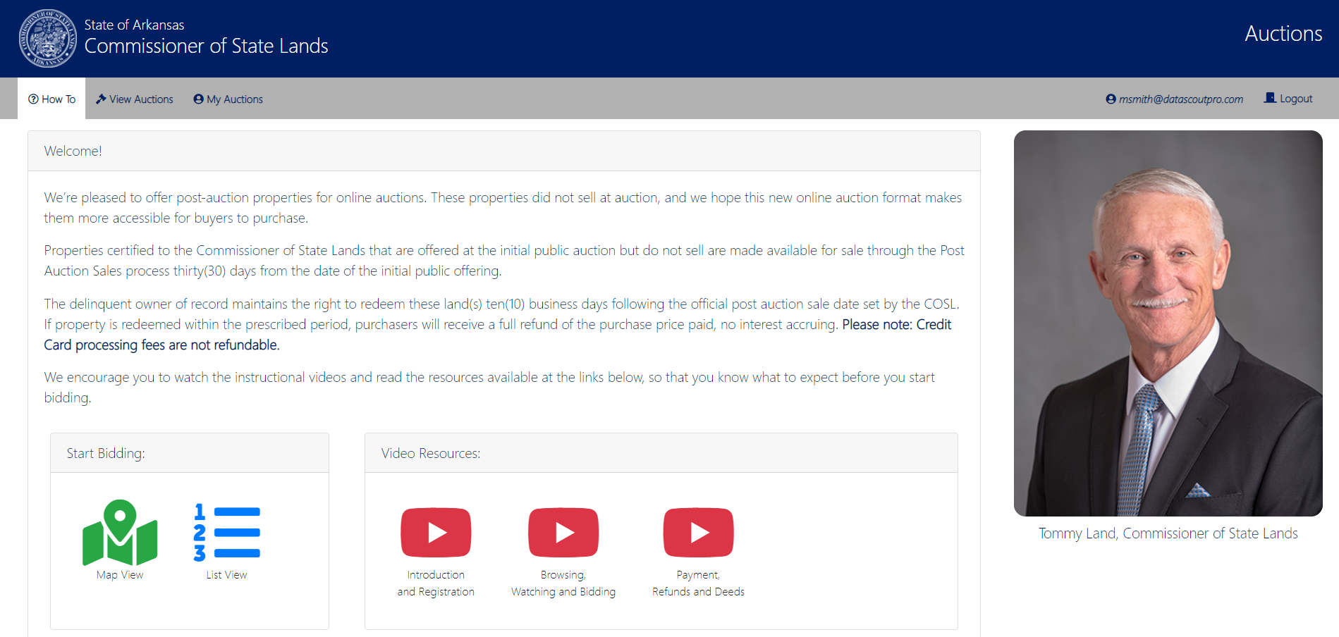
The Arkansas Commissioner of State Lands (CoSL) desired to move the auctioning of certified properties to an online format. The goal was to provide greater visibility of properties up for auction to potential bidders across the country and drive competitive bidding to generate more revenue per auction. An additional benefit to an online format was allowing auctions to continue when the physical bidding process became impractical or impossible due to external factors.
DataScout was able to tailor the online process to fit the needs of their existing workflow and maintain compliance with Arkansas statutes.
Working alongside the CoSL staff, DataScout was able to establish communications between the new online system and their in house Land System for critical updates throughout the bidding process.
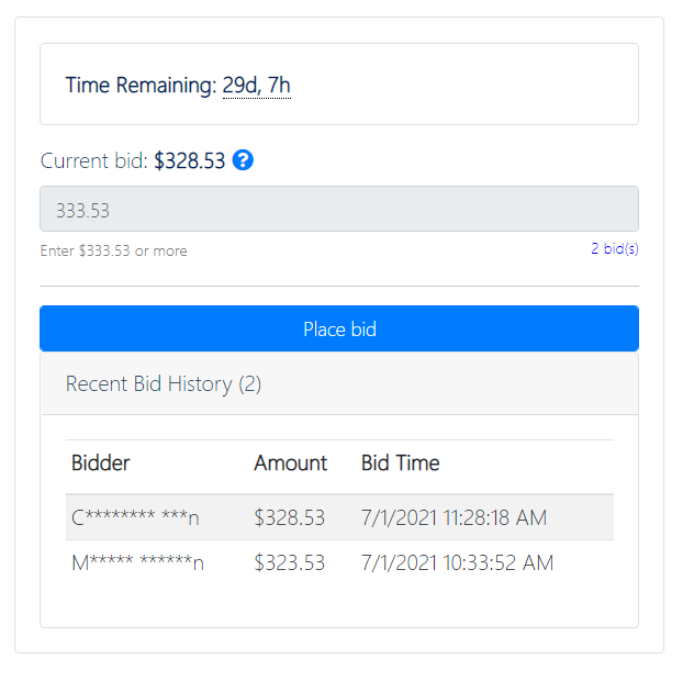
Critical success factors included responsive and instant feedback to all bidders on the web application, payment processing, map based searching and provisioning and maintaining the underlying cloud infrastructure.
CoSL Waterways Reporting
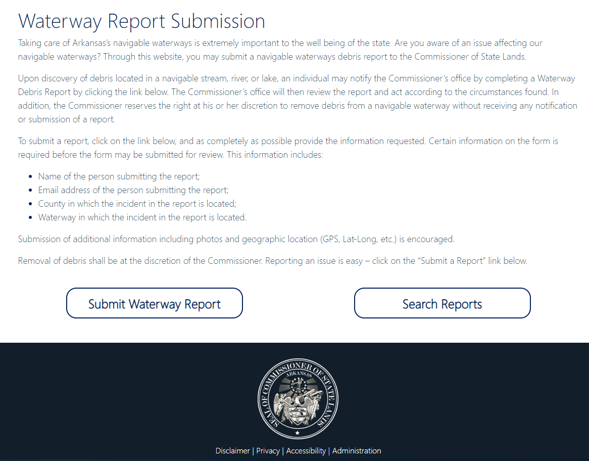
The CoSL needed a web application to accept and track reports for waterway debris throughout the state. This single repository and one click download for all correspondence, videos, photos and miscellaneous documentation satisfies Freedom of Information Act requests with the click of a button.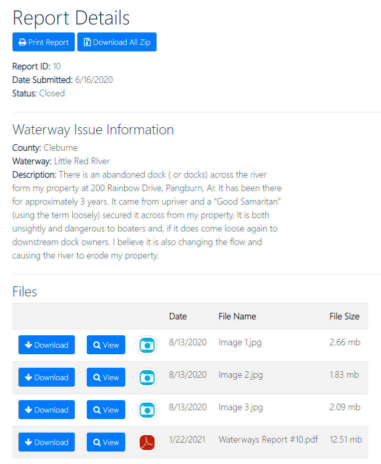
Engaging with multiple state agencies, education institutions as well as county and local officials, DataScout developed a comprehensive web application designed to organize, manage,
document and store fire service information in a central location.
Decades of data collected via various methods including spreadsheets, paper forms and a range of database types were cleaned and consolidated to
provide the public with a comprehensive view of fire services in their area.
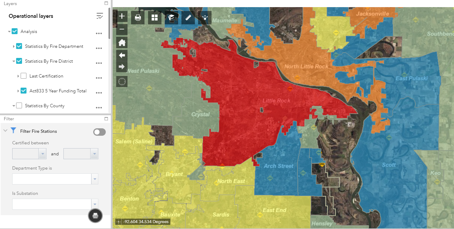
Data analysis is presented in an easily digestible format through our GIS overlays, providing state agencies with a comprehensive view of their previous support actions
and total funding across agencies on a fire district or county-wide level.
ACT 833
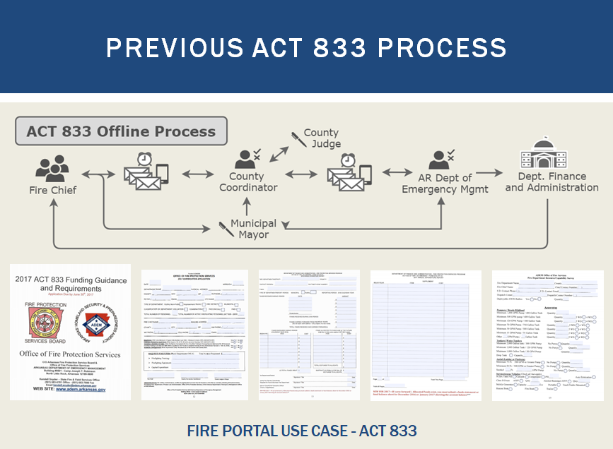
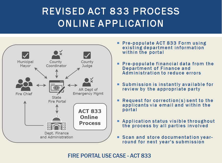
ACT 833 funding is the primary source of financial aid for fire protection services. DataScout converted this critical process to an online application with customized views for each user according to their role and data access needs. Users can instantly communicate approvals or rejections, and revisions can quickly be returned to the appropriate party on the application's path to approval.
This application provides the Arkansas Department of Emergency Management (ADEM) critical insight into each fire department's capabilities and finances. DataScout was able to interface directly with the Arkansas Department of Finance and Administration to auto-fill each fire department's previous financial data, ensuring accuracy for each applicant. Now, the updating of equipment, bank statements and receipts, station rosters and contact information is available online to all chiefs and county coordinators in
the state utilizing the Fire Services Directory.
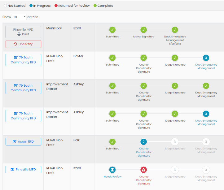 An admin's dashboard summarizing department applications in process
Arkansas Forestry Commission
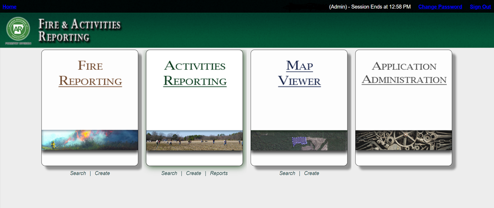
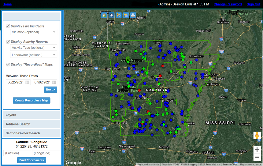
Fire and Activities Reporting Portal
The AFC FAR Portal was developed with the primary goal of streamlining the collection of fire and activity reports from the numerous AFC employees across the state. Previously, copies of Access databases were circulated amongst offices which were regularly returned to the AFC headquarters for synchronization back to the master dataset. GIS data was collected separately in professional GIS software which required high levels of training of many employees. The administrative requirements, coordination, duplication of efforts, and potential for errors made this process an ideal project for streamlining.
The FAR Portal combined both the Fire and Activities Reporting databases into a single system along with all mapping. All forms are designed to be simple and straightforward with criteria that hide unnecessary information and fields, provide calculations where possible, and enforce data integrity. A mapping system was integrated into FAR to allow an easy and cost affective means for any user to create maps by drawing geographic features or uploading data from shapefiles, gpx, or even kml files. This decreased the AFC’s reliance on large professional GIS software and the resulting training requirements for a large portion of their staff. The system also provides users the ability to upload and attach any type of files to fire and activity reports. All data attached to a report, including mapping and attachments, can be exported quickly and easily to the user’s computer, or zipped and sent as an email directly from the Portal. All administrative tasks are built into the portal to allow for ease of changing items such as unit costs, drop down lists, map symbology, and security. Security is fine grained and easily allows administrators to limit users read/write permissions to individual counties, districts, or certain types of reporting.
 ☰
☰
